Essential information for preparing your hike
| Difficulty | Easy | |
| Distance | 4.1 KM | |
| Height / altitude | 50 meters | |
| Elevation gain | 50 meters |
Trail maps

Photos
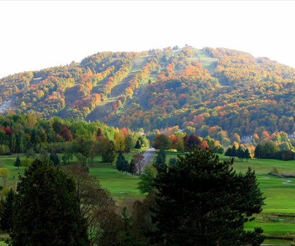
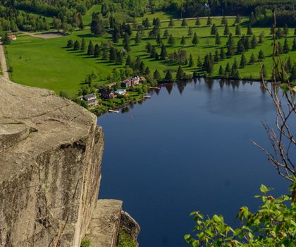
This park, with an area of 27 hectares, is located at the confluence of the St. Francis and Eaton. The trail of the Four joined the old dam of the name. You can see the remains are of a boom for holding the wood. Draveur The trail has a gazebo overlooking the confluence of the rivers. Wild cherry trees on the trail, there is a horticultural nursery containing 200 varieties of perennials and more than 3 000 plants. The Riv-O-Bois trail goes through a spruce plantation Norway and red pine. The trail Little ladder leads to the river through a staircase of nearly 100 steps
The Parc des deux rivières is a beautiful park located in the Cantons-de-l'Est region of Quebec. The park is situated on the banks of the Saint Lawrence River and the Richelieu River, and offers stunning views of both waterways. The park is a popular spot for hiking, biking, and fishing, and is also home to a variety of wildlife, including deer, beavers, and eagles. The park is open year-round, and is a great place to spend a day or a weekend exploring the natural beauty of Quebec.
Useful infos
Rate & open hour
45.4752
Address
Starting Point
The trails at the Parc des deux rivières in Cantons-de-l'Est can be accessed from Rue Principale.
FAQ - Frequently asked questions
What is the level of difficulty of Parc des deux rivières ?
What is the elevation of Parc des deux rivières?
What is the height of Parc des deux rivières ?
Is the place are families friendly?
Is there an information center / service center / reception?
Similar hikes nearby


She life was a celebration of adventure, joy, and the great outdoors. She lived with a fierce determination to enjoy every moment and to share that joy with others. Her legacy is one of laughter, exploration, and an unwavering love for the natural world. Lydia's spirit continues to inspire those who knew her and those who discover her story, reminding us all to embrace life with open arms and a heart full of joy.
Hikers' opinions
0 out of 5 stars
Based on 0 reviews