Essential information for preparing your hike
| Difficulty | Moderate | |
| Distance | 4.4 KM | |
| Height / altitude | 664 meters | |
| Elevation gain | 296 meters | |
| Dog allowed | ||
| Child friendly |
Trail maps

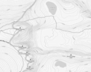
Trails available at Mont Pinacle - Parc Harold F. Baldwin
List of suggested loops and routes
| Trails | Distance | Elevation | Type | Difficulty |
|---|---|---|---|---|
Sentier de l'Érablière |
1.91 km | 0 m | Linear | Beginner |
Sentier de la Rocheuse |
0.55 km | 0 m | Linear | Beginner |
Sentier du Petit lac |
0.26 km | 0 m | Linear | Beginner |
Sentier Faucon Pèlerin |
0.51 km | 0 m | Linear | Beginner |
Sentier le Grimpeur |
1 km | 0 m | Linear | Beginner |
Sentier Mead |
0.5 km | 0 m | Linear | Beginner |
Mont Pinacle |
4.41 km | 212 m | Loop | Intermediate |
↔️ Glissez pour voir tous les détails
Photos
Discover Mont Pinacle: A Hiker's Paradise in the Cantons-de-l'Est
Welcome to mont pinacle, a hidden gem nestled in the heart of the picturesque Cantons-de-l'Est region. If you're a hiker, outdoor enthusiast, or simply someone who loves spending time in nature, this is the perfect destination for you.
A Scenic Escape
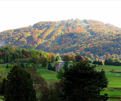
mont pinacle offers an unforgettable hiking experience with its well-maintained trails and breathtaking views. Standing at 675 meters, this mountain provides a moderate challenge suitable for both seasoned hikers and beginners looking to explore the great outdoors. The trails are clearly marked, ensuring a safe and enjoyable journey through lush forests and rocky terrains.
Trail Highlights
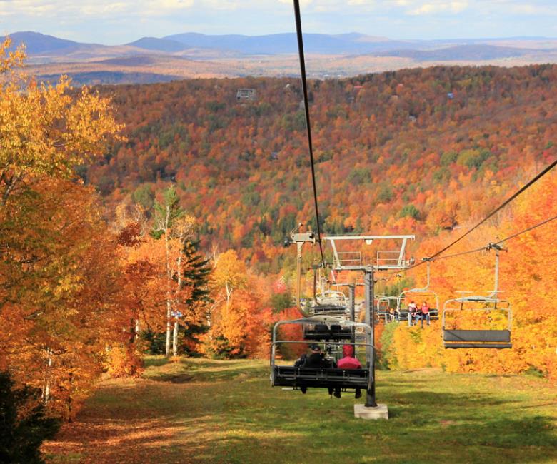
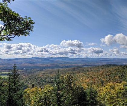
As you ascend mont pinacle, you'll be surrounded by diverse flora and fauna that make this area truly special. Keep your eyes peeled for local wildlife such as deer and various bird species that call this region home. The summit rewards your efforts with panoramic vistas of the surrounding landscape, including stunning views of Lake Lyster and the rolling hills of the Eastern Townships.
Family-Friendly Adventure
mont pinacle is not just for avid hikers; it's also a fantastic spot for families seeking a day out in nature. The main trail is accessible enough for children, making it an ideal location for introducing young ones to the joys of hiking. Pack a picnic and enjoy lunch with a view at one of the designated rest areas along the trail.
Plan Your Visit
The best time to visit mont pinacle is during the warmer months from late spring to early fall when the weather is perfect for hiking. However, each season brings its own unique charm—whether it's the vibrant colors of autumn leaves or the serene beauty of winter snowshoeing.
Before you set off on your adventure, make sure to check local guidelines and trail conditions. Remember to bring plenty of water, wear appropriate footwear, and respect nature by leaving no trace behind.
Getting There
mont pinacle is conveniently located near Coaticook in Quebec's Cantons-de-l'Est region. It's easily accessible by car, with ample parking available at the trailhead. Whether you're planning a day trip or incorporating it into a longer stay in the area, mont pinacle promises an enriching outdoor experience.
So lace up your hiking boots and get ready to explore one of Quebec's most beautiful natural landscapes. mont pinacle awaits your discovery!
Services and activities on site
Useful infos
Rate & open hour
45.0369255
Address
Starting Point
Mount Pinnacle is just a few kilometers from the Nature Discovery Park. Hike 3 kilometers to the top of the mountain, the top of the mountain is 675 m (2,215 feet) above sea level, and you can enjoy the spectacular scenery.
There are several options of 2 to 3 km for the return trip.
Other starting point option:
You can park your car at Nature Discovery Park, and follow the Mills Trail to Baldwin Village, then follow the Pinnacle Mountain Trail. From there, it's a 7 km round trip.
FAQ - Frequently asked questions
What is the level of difficulty of Mont Pinacle - Parc Harold F. Baldwin ?
What is the elevation of Mont Pinacle - Parc Harold F. Baldwin?
What is the height of Mont Pinacle - Parc Harold F. Baldwin ?
What are the opening hours?
Are dogs allowed?
Is the place are families friendly?
How much does a ticket cost?
Do I have to pay for parking?
Is there an information center / service center / reception?
Similar hikes nearby


She life was a celebration of adventure, joy, and the great outdoors. She lived with a fierce determination to enjoy every moment and to share that joy with others. Her legacy is one of laughter, exploration, and an unwavering love for the natural world. Lydia's spirit continues to inspire those who knew her and those who discover her story, reminding us all to embrace life with open arms and a heart full of joy.


Hikers' opinions
5 out of 5 stars
Based on 14 reviews
5 out of 5 stars
6 years ago5 out of 5 stars
6 years ago