Essential information for preparing your hike
| Difficulty | Easy | |
| Distance | 82.2 KM | |
| Height / altitude | 853 meters | |
| Elevation gain | 725 meters | |
| Dog allowed | ||
| Child friendly |
Trail maps

Trails available at Parc National Du Mont-Orford
List of suggested loops and routes
| Trails | Distance | Elevation | Type | Difficulty |
|---|---|---|---|---|
Sentier de la Sitelle |
1.6 km | Linear | Beginner | |
Sentier du Coyote |
1.6 km | Loop | Beginner | |
Chemin d'accès au Vallonnier |
5 km | Linear | Intermediate | |
Lien mont Orford - salle communautaire |
6.2 km | Linear | Intermediate | |
Sentier de la Chouette |
3.8 km | Mixt | Intermediate | |
Sentier de la Gélinotte |
3.7 km | Linear | Intermediate | |
Sentier du Lynx |
3.8 km | Linear | Intermediate | |
Sentier du Pékan |
4.1 km | Linear | Intermediate | |
Boucle du Mont-Chauve |
6.5 km | Loop | Advanced | |
Sentier des Loutres |
4.3 km | Loop | Advanced | |
Sentier du Cerf |
8.5 km | Loop | Advanced | |
Sentier du Ruisseau-David |
4.2 km | Loop | Advanced | |
Sentier du Ruisseau-des-Chênes |
2.9 km | Linear | Advanced |
↔️ Glissez pour voir tous les détails
Photos
If you are visiting Quebec City, come and enjoy a relaxing moment with your family or friends at Mont Orford. With its national park, this magnificent territory seduces with its countless activities and the beauty of its landscapes. From cross-country skiing to hiking or kayaking, the discovery activities are adapted to the needs of each visitor. Let's discover all the wonders of Mount Orford.
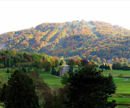
Mount Orford: the fourth highest peak in Quebec
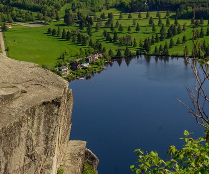
Located in the municipality of Orford, Quebec, Canada, Mount Orford is located west of Mount Giroux, east of Mount Sylvio-Lacharité and south of Mount Alfred-DesRochers. With its 853 meters of altitude, it is the highest skiable domain in the Eastern Townships. From Mount Orford flow four slopes including the Versant stream, the Des Chênes stream and the Giroux stream. Being the fourth highest peak in Quebec, Mount Orford is sheltered in the Parc national du Mont-Orford. With a surface area of 59.5 km2, take advantage of the park's many activities to relax in the heart of nature and why not spot white-tailed deer and great blue herons!
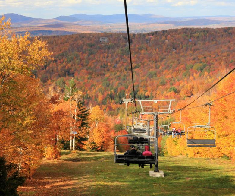
A must-see ski resort
When talking about Mount Orford, it is impossible not to mention cross-country skiing, which is the park's reputation. The park has a total of thirteen ski trails with 50 km of classic and 26 km of skate trails. Whether beginners or experts, each skier will find the trail that suits him or her thanks to the markings and tracings.
Hiking: an activity for the whole family
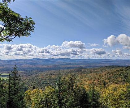
Hiking is undoubtedly the best way to contemplate the beauty of Parc national du Mont-Orford. It is the perfect opportunity to enjoy spectacular views of the Eastern Townships. With more than 80 km of trails, hiking is dedicated to the whole family for exceptional moments of discovery. You can hike the Sentiers de l'Estrie which crosses the park from north to south.
Other fun activities to enjoy...
In Mont-Orford Park, discovery activities can be done in groups. Between the Fraser Lake Sector and the Stukely Lake Sector, there is an embarrassment of riches to choose from. Those who like campfires can choose the Chouette soirée d'Orford to talk about owls. A night safari is also very tempting for sensory experiences on the trail without flashlights at night.
In short, Mount Orford and its national park are a paradise for those who want to have fun in a different way!
https://www.cantonsdelest.com/quoi-faire/223/parc-national-du-mont-orford
Services and activities on site
Useful infos
Rate & open hour
45.3227754
Address
Starting Point
To access the hiking trails, you can start at several trailheads. One main entry point is located at 3321 Chemin du Parc, Orford, QC J1X 7A2. Another option is to begin your hike from the parking area at 69 Chemin du Camping, Orford, QC J1X 7A2. Both locations provide convenient access to the trails and have parking facilities available.
FAQ - Frequently asked questions
What is the level of difficulty of Parc National Du Mont-Orford ?
What is the elevation of Parc National Du Mont-Orford?
What is the height of Parc National Du Mont-Orford ?
What are the opening hours?
Are dogs allowed?
Is the place are families friendly?
How much does a ticket cost?
Is there an information center / service center / reception?
Similar hikes nearby


She life was a celebration of adventure, joy, and the great outdoors. She lived with a fierce determination to enjoy every moment and to share that joy with others. Her legacy is one of laughter, exploration, and an unwavering love for the natural world. Lydia's spirit continues to inspire those who knew her and those who discover her story, reminding us all to embrace life with open arms and a heart full of joy.
Hikers' opinions
4 out of 5 stars
Based on 28 reviews
5 out of 5 stars
6 years ago5 out of 5 stars
6 years ago5 out of 5 stars
7 years ago3 out of 5 stars
10 years ago