Essential information for preparing your hike
| Difficulty | Moderate | |
| Distance | 22 KM | |
| Estimated Time | 6 to 8 hours. | |
| Elevation gain | 1,230 meters |
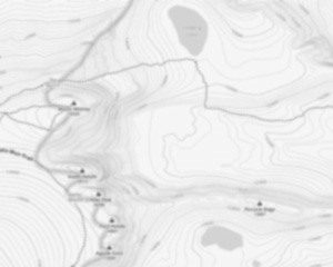
Trail maps

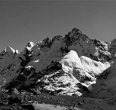
Photos
Mount Colvin is the 39th highest peak in the High Peaks Region of the Adirondack Mountains, in the state of New York, USA. Mount Colvin offers excellent views of a number of other Adirondack High Peaks, most notably the peaks that comprise the Great Range. High Peaks that are readily visible from Colvin include Giant, Rocky Peak Ridge, Upper Wolfjaw, Lower Wolfjaw, Armstrong, Sawteeth, Gothics, Saddleback, Basin, Tabletop, Marcy, Haystack, Redfield, Allen, Nippletop, Dial, and Blake. The mountain is named after Verplanck Colvin, an explorer of the Adirondacks and the director of the survey which mapped the region. After naming many other peaks and geographic features, he chose this less-prominent mountain to name after himself.
The Mount Colvin is located in the Adirondacks, in New York. It is a peak that rises to an elevation of 4,620 feet and it offers some of the best views in the area. The summit can be reached by following the Colvin Brook Trail, which is a moderate hike that takes around three hours to complete. The trailhead is located at the end of Elk Lake Road, which is a popular spot for fishing and camping.
The views from the summit of Mount Colvin are stunning, with 360-degree panoramas of the surrounding mountains and valleys. On a clear day, you can see as far as the Vermont border. The summit is also home to a number of interesting geological features, including a large boulder known as “The Thimble”.
Mount Colvin is a popular destination for hikers and climbers, and there are a number of different routes to the summit. The most popular route is the Colvin Brook Trail, which is well-marked and relatively easy to follow. There are also a number of other trails in the area that offer more challenging climbs.
If you’re looking for a great hike with amazing views, Mount Colvin is definitely worth checking out. The summit is accessible by a moderate hike that takes around three hours to complete, and the views are well worth the effort.
For those seeking additional adventures near Mount Colvin, consider exploring Lower Ausable Lake via Gill Brook Trail. This scenic path provides access to breathtaking vistas and connects hikers to other notable spots such as Mills Blake and Blake Peak. These areas are part of what some refer to as package range hikes within this region.
Another noteworthy aspect about hiking in this area includes understanding range valid permits required for certain trails like those leading through Elk Pass or towards Amr destinations; these permits ensure sustainable use while preserving natural beauty throughout Adk territories.
Information on these trails can often be found on Wikipedia or local guides detailing routes valid Feb through late fall when conditions allow safe passage across rugged terrains typical hereabouts.
Useful infos
Rate & open hour
44.094202
Address
Starting Point
The easiest way to get to the start of the trails at Mount Colvin is to drive to Keene Valley and then take the Adirondack Mountain Club shuttle.
FAQ - Frequently asked questions
What is the level of difficulty of Mount Colvin, New York ?
What is the elevation of Mount Colvin, New York?
How long on average?
Is the place are families friendly?
Is there an information center / service center / reception?

She life was a celebration of adventure, joy, and the great outdoors. She lived with a fierce determination to enjoy every moment and to share that joy with others. Her legacy is one of laughter, exploration, and an unwavering love for the natural world. Lydia's spirit continues to inspire those who knew her and those who discover her story, reminding us all to embrace life with open arms and a heart full of joy.

Hikers' opinions
3 out of 5 stars
Based on 7 reviews
3 out of 5 stars
10 years ago3 out of 5 stars
10 years ago3 out of 5 stars
10 years ago