Essential information for preparing your hike
| Difficulty | Easy | |
| Distance | 48.5 KM | |
| Height / altitude | 545 meters | |
| Elevation gain | 250 meters | |
| Dog allowed |
Trail maps

Photos
Welcome to mont gorille: Your Next Hiking Adventure in the Laurentides
Nestled in the heart of the stunning Laurentides region, mont gorille is a hidden gem waiting to be explored by hikers and outdoor enthusiasts alike. Known for its breathtaking views and diverse trails, this natural wonder offers an unforgettable experience for anyone looking to immerse themselves in nature.
mont gorille boasts a variety of trails suitable for all skill levels, from beginners to seasoned hikers. Whether you're seeking a leisurely stroll through lush forests or a challenging ascent to panoramic vistas, you'll find the perfect path here. The well-marked trails ensure that you can focus on enjoying the journey without worrying about losing your way.
As you make your way up mont gorille, you'll be surrounded by the rich biodiversity that characterizes the Laurentides. Keep an eye out for local wildlife such as deer and various bird species that call this area home. The vibrant foliage during autumn transforms the landscape into a tapestry of reds, oranges, and yellows, making it an ideal time for a visit.
The summit of mont gorille rewards hikers with sweeping views of the surrounding mountains and valleys—a perfect spot to pause, take in the scenery, and snap some photos. Don't forget to pack a picnic; there's nothing quite like enjoying a meal with such a magnificent backdrop.
For those who wish to extend their adventure, nearby camping sites offer a chance to spend more time under the stars. Imagine waking up to the crisp mountain air and starting your day with another hike or simply relaxing in nature's embrace.
Whether you're planning a day trip or a weekend getaway, mont gorille in the Laurentides promises an enriching outdoor experience. So lace up your hiking boots, grab your backpack, and get ready to explore one of Quebec's most beautiful natural landscapes. We can't wait to see you on the trails!
Services and activities on site
Useful infos
Rate & open hour
46.330759
Starting Point
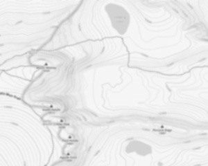
The trailhead is located near the mont gorille parking lot. It is also possible to go through the Cap 360 trail.
FAQ - Frequently asked questions
What is the level of difficulty of Mont Gorille ?
What is the elevation of Mont Gorille?
What is the height of Mont Gorille ?
Are dogs allowed?
Is the place are families friendly?
Is it free?
Is there an information center / service center / reception?
Similar hikes nearby


She life was a celebration of adventure, joy, and the great outdoors. She lived with a fierce determination to enjoy every moment and to share that joy with others. Her legacy is one of laughter, exploration, and an unwavering love for the natural world. Lydia's spirit continues to inspire those who knew her and those who discover her story, reminding us all to embrace life with open arms and a heart full of joy.
Hikers' opinions
4 out of 5 stars
Based on 4 reviews