Essential information for preparing your hike
| Difficulty | Easy | |
| Distance | 11.8 KM | |
| Elevation gain | 200 meters | |
| Dog allowed |
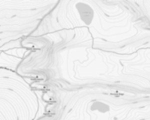
Trail maps

Trails available at Le Nid De L'aigle Et Le Mont Larose
List of suggested loops and routes
| Trails | Distance | Elevation | Type | Difficulty |
|---|---|---|---|---|
Sentier rouge |
5.1 km | 0 m | Linear | Intermediate |
Boucle |
3.9 km | 0 m | Loop | Intermediate |
Sentier bleu |
2.8 km | 200 m | Linear | Intermediate |
↔️ Glissez pour voir tous les détails
Photos
Discover the Majestic Trails of Le Nid De L'aigle and Mont Larose in the Laurentides
Welcome to the breathtaking Laurentides, a haven for hikers and outdoor enthusiasts seeking adventure and tranquility amidst nature's splendor. Nestled within this picturesque region are two gems waiting to be explored: Le Nid De L'aigle and Mont Larose. Whether you're an experienced hiker or someone looking to immerse yourself in the great outdoors, these trails offer something truly special.
Le Nid De L'aigle: A Bird's Eye View
Le Nid De L'aigle, translating to "The Eagle's Nest," is aptly named for its stunning vantage points that provide panoramic views of the surrounding landscape. As you ascend this trail, you'll find yourself enveloped by lush forests and serenaded by the gentle rustling of leaves. The trail is moderately challenging, making it perfect for those who enjoy a bit of a workout while being rewarded with awe-inspiring vistas.
At the summit, prepare to be captivated by sweeping views that stretch as far as the eye can see. It's a perfect spot to pause, take in the beauty of nature, and perhaps even spot an eagle soaring high above—truly living up to its name.
Mont Larose: A Journey Through Nature's Beauty
Just a stone's throw away lies Mont Larose, another must-visit destination for hiking aficionados. This trail offers a slightly different experience, with its diverse terrain and rich biodiversity. As you make your way through Mont Larose, you'll encounter a variety of flora and fauna unique to the Laurentides region.
The trail is well-marked and suitable for hikers of all levels, making it an ideal choice for families or groups with varying abilities. Along the way, you'll discover serene spots perfect for picnicking or simply soaking in the peaceful ambiance.
Tips for Your Adventure
- Plan Ahead: Check weather conditions before heading out and ensure you have appropriate gear.
- Stay Hydrated: Bring plenty of water, especially during warmer months.
- Respect Nature: Stick to marked trails and carry out any trash you bring in.
- Capture Memories: Don't forget your camera or smartphone to capture the stunning landscapes!
Whether you're seeking solitude in nature or an exhilarating hike with friends, Le Nid De L'aigle and Mont Larose offer unforgettable experiences that showcase the natural beauty of the Laurentides. Lace up your hiking boots and embark on an adventure that promises both challenge and serenity in equal measure.
Services and activities on site
Useful infos
Rate & open hour
45.9465661
Address
Starting Point
The Mont Larose trailhead is located in Saint-Sauveur, in the Laurentian region. To get there, take Highway 15 North and exit at Exit 66. Then take route 158 East and continue to Saint-Sauveur. The trailhead is on the right, after the bridge.
FAQ - Frequently asked questions
What is the level of difficulty of Le Nid De L'aigle Et Le Mont Larose ?
What is the elevation of Le Nid De L'aigle Et Le Mont Larose?
Are dogs allowed?
Is the place are families friendly?
Is there an information center / service center / reception?
Similar hikes nearby


She life was a celebration of adventure, joy, and the great outdoors. She lived with a fierce determination to enjoy every moment and to share that joy with others. Her legacy is one of laughter, exploration, and an unwavering love for the natural world. Lydia's spirit continues to inspire those who knew her and those who discover her story, reminding us all to embrace life with open arms and a heart full of joy.
Hikers' opinions
4 out of 5 stars
Based on 10 reviews
4 out of 5 stars
10 years ago3 out of 5 stars
11 years ago4 out of 5 stars
11 years ago