Essential information for preparing your hike
| Difficulty | Moderate | |
| Distance | 141.9 KM | |
| Height / altitude | 717 meters | |
| Elevation gain | 449 meters | |
| Dog allowed |
Trail maps

Trails available at Parc régional du Massif du Sud
List of suggested loops and routes
| Trails | Distance | Elevation | Type | Difficulty |
|---|---|---|---|---|
Parcours du mont Chocolat |
8.3 km | 380 m | Linear | Intermediate |
Parcours de la Vieille forêt |
4.8 km | 221 m | Loop | Intermediate |
Parcours des Passerelles |
4.6 km | 147 m | Loop | Intermediate |
Parcours des Abris-sous-roche |
4.3 km | 235 m | Linear | Intermediate |
Parcours des Parois |
9 km | 449 m | Linear | Advanced |
Parcours des Ravages |
9 km | 468 m | Loop | Advanced |
Parcours de la Grande boucle (2 jours) |
28.4 km | 1214 m | Loop | Advanced |
Parcours des Géants |
18 km | 723 m | Loop | Advanced |
Parcours de l'Exploration |
16 km | 756 m | Linear | Advanced |
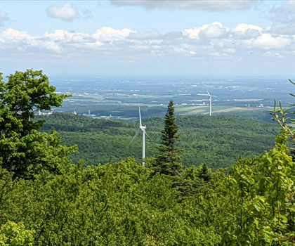
Parcours des Éoliennes |
15 km | 440 m | Linear | Advanced |
Parcours du mont Saint-Magloire |
13.9 km | 641 m | Linear | Advanced |
Parcours de la crête des Grives |
11 km | 449 m | Linear | Advanced |
↔️ Glissez pour voir tous les détails
Photos
Welcome to the parc régional du massif du sud, a hidden gem nestled in the heart of the Chaudière-Appalaches region. If you're a hiker, outdoor enthusiast, or simply someone looking to immerse yourself in nature's splendor, this park is your perfect destination.
Spanning over 120 square kilometers, the parc régional du massif du sud offers an impressive array of landscapes and activities that cater to all levels of adventurers. From lush forests and serene rivers to rugged mountains and breathtaking vistas, every corner of this park invites exploration and discovery.
For hiking enthusiasts, the park boasts an extensive network of trails that wind through diverse terrains. Whether you're seeking a leisurely stroll or a challenging ascent, you'll find a path that suits your pace. The Mont Chocolat trail is particularly popular, offering panoramic views from its summit that are well worth the climb. As you trek through these trails, keep an eye out for local wildlife such as deer and various bird species that call this park home.
Beyond hiking, the parc régional du massif du sud provides opportunities for mountain biking, snowshoeing, and cross-country skiing during the winter months. Each season brings its own unique charm to the landscape, ensuring there's always something new to experience.
The park is committed to preserving its natural beauty while providing visitors with memorable experiences. Facilities such as picnic areas and campsites are available for those who wish to extend their stay and fully embrace the tranquility of the great outdoors.
Whether you're planning a day trip or a longer getaway, the parc régional du massif du sud promises an unforgettable adventure filled with stunning scenery and invigorating activities. So lace up your hiking boots, pack your sense of wonder, and get ready to explore one of Chaudière-Appalaches' most captivating natural treasures!
Services and activities on site
Useful infos
Rate & open hour
46.6292752
Address
Starting Point
To access the hiking trails, you can start at the main entrance parking lot located at 300 Route du Massif, Saint-Philémon, QC G0R 4A0. There are no additional trailheads with separate addresses; all trails can be accessed from this central location.
FAQ - Frequently asked questions
What is the level of difficulty of Parc régional du Massif du Sud ?
What is the elevation of Parc régional du Massif du Sud?
What is the height of Parc régional du Massif du Sud ?
Are dogs allowed?
Is the place are families friendly?
How much does a ticket cost?
Is there an information center / service center / reception?
Similar hikes nearby


She life was a celebration of adventure, joy, and the great outdoors. She lived with a fierce determination to enjoy every moment and to share that joy with others. Her legacy is one of laughter, exploration, and an unwavering love for the natural world. Lydia's spirit continues to inspire those who knew her and those who discover her story, reminding us all to embrace life with open arms and a heart full of joy.
Hikers' opinions
5 out of 5 stars
Based on 10 reviews
4 out of 5 stars
6 years ago