Essential information for preparing your hike
| Difficulty | Easy | |
| Distance | 44 KM | |
| Height / altitude | 350 meters | |
| Elevation gain | 350 meters | |
| Dog allowed |
Trail maps

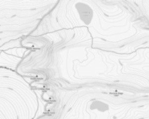
Trails available at Parc National Des Monts-valin
List of suggested loops and routes
| Trails | Distance | Elevation | Type | Difficulty |
|---|---|---|---|---|
Le Mirador |
7.5 km | 70 m | Loop | Beginner |
Le Point de vue |
5 km | 100 m | Loop | Beginner |
Le Lac-des-Pères |
3 km | 50 m | Loop | Beginner |
Pic 360 |
7 km | 830 m | Loop | Intermediate |
Le Couloir de l'Est |
5.5 km | Linear | Intermediate | |
Le Fantôme - Le Pionnier |
4.5 km | Linear | Intermediate | |
Ulysse |
4 km | 420 m | Linear | Intermediate |
La Vallée des Fantômes |
3 km | 275 m | Linear | Intermediate |
Le Fantôme - Le Piedmont |
6.5 km | Linear | Advanced | |
Le Pic-de-la-Tête-de-Chien |
2.5 km | 340 m | Linear | Advanced |
Le Pic-du-Grand-Corbeau |
2 km | 590 m | Linear | Advanced |
Le Pic-de-la-Hutte |
2 km | 670 m | Linear | Advanced |
Sentier des Plateaux |
12 km | 110 m | Loop | Advanced |
↔️ Glissez pour voir tous les détails
Photos
With an area of 153.7 km2, the Monts Valin National Park is one of the most important natural parks inQuebec. It is located in the Saquenay-Lac-Saint-Jean region, on the north bank of the Saguenay River.
The park was created in 1996 to preserve the beauty of the Valin Mountains and is a popular destination for those who love outdoor living. From a landscape point of view,the Valin Mountains National Park presents a unique wilderness,made up of peaks that range from 300m to 900m and valleys, such as the canyon of the Sainte-Marguerite River.
Here is the reign of hiking,which can be practiced throughout the year, thanks to the many setiersthat allow you tocovereachtimedifferentaspects of theMonts Valin.
The trails are classified from easy to high difficulty and have avaried length, so you can choose the one that best suits your requirements!
A recommended trail
A well-known hiking trail in the Valin Mountains National Park is the Pic-de-la-Hutte. This trail has two different variants,having a way back and forth:
· The full version, which is longue about 16km and has a670m drop
· The abbreviated version, long 3km, avec a70m dereve.
Both variants are accessible from May to October and culminate at Pic-de-la-Hutte, one of the highest peaks in the park. This one, with its 900m altitude, offers a magnificent view of the city of Saguenay and the border of Lake Saint Jean.
The longest trail has an easy time and is recommended for expert hikers,when the abbreviated version is also suitable for families. There are two different starting points:
· The Discovery and Services Centre, which is located near the park's reception
· The Pic-de-la Hut Parking, 9km from the Discovery and Services Centre
Services and activities on site
Useful infos
Rate & open hour
Tuesday: 8:00 AM – 5:00 PM
Wednesday: 8:00 AM – 5:00 PM
Thursday: 8:00 AM – 5:00 PM
Friday: 8:00 AM – 5:00 PM
Saturday: 8:00 AM – 5:00 PM
Sunday: 8:00 AM – 5:00 PM
48.58000200000001
Address
Starting Point
To access the hiking trails, you can start at the main trailhead located at the park's Discovery and Visitors Centre. The address is 360 Rang Saint-Louis, Saint-Fulgence, QC G0V 1S0. There are also several other trailheads within the park that can be accessed from different points along the park's road network. Make sure to check for specific directions to each trailhead based on your chosen route.
FAQ - Frequently asked questions
What is the level of difficulty of Parc National Des Monts-valin ?
What is the elevation of Parc National Des Monts-valin?
What is the height of Parc National Des Monts-valin ?
What are the opening hours?
Tuesday: 8:00 AM – 5:00 PM
Wednesday: 8:00 AM – 5:00 PM
Thursday: 8:00 AM – 5:00 PM
Friday: 8:00 AM – 5:00 PM
Saturday: 8:00 AM – 5:00 PM
Sunday: 8:00 AM – 5:00 PM
Are dogs allowed?
Is the place are families friendly?
How much does a ticket cost?
Is there an information center / service center / reception?
Similar hikes nearby


She life was a celebration of adventure, joy, and the great outdoors. She lived with a fierce determination to enjoy every moment and to share that joy with others. Her legacy is one of laughter, exploration, and an unwavering love for the natural world. Lydia's spirit continues to inspire those who knew her and those who discover her story, reminding us all to embrace life with open arms and a heart full of joy.
Hikers' opinions
4 out of 5 stars
Based on 14 reviews
4 out of 5 stars
10 years ago4 out of 5 stars
11 years ago3 out of 5 stars
11 years ago4 out of 5 stars
11 years ago