Essential information for preparing your hike
| Difficulty | Easy | |
| Distance | 2 KM | |
| Height / altitude | 300 meters | |
| Elevation gain | 300 meters | |
| Dog allowed |
Trail maps

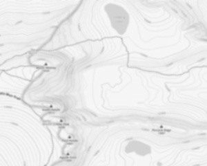
Trails available at Mont Sourire
List of suggested loops and routes
| Trails | Distance | Elevation | Type | Difficulty |
|---|---|---|---|---|
Mont Sourire |
2 km | 120 m | Linear | Beginner |
↔️ Glissez pour voir tous les détails
Photos
Discover the Natural Beauty of Mont Sourire in Lanaudière
Welcome to mont sourire, a hidden gem nestled in the heart of the picturesque Lanaudière region. If you're a hiker, outdoor enthusiast, or simply someone looking to escape into nature's embrace, mont sourire is your perfect destination.
A Hiker’s Paradise
mont sourire offers an array of trails that cater to all levels of hikers. Whether you're a seasoned trekker or just starting out, you'll find a path that suits your pace and skill level. The trails are well-marked and maintained, ensuring a safe and enjoyable experience for everyone.
Breathtaking Views
As you ascend the trails of mont sourire, prepare to be rewarded with stunning panoramic views of the surrounding landscape. The summit provides a breathtaking vantage point where you can soak in the beauty of rolling hills, lush forests, and sparkling lakes that define the Lanaudière region.
Flora and Fauna
Nature lovers will delight in the diverse flora and fauna that call mont sourire home. Keep an eye out for native wildlife such as deer, foxes, and a variety of bird species. The vibrant wildflowers and towering trees add to the enchanting atmosphere of this natural haven.
Perfect for All Seasons
mont sourire is not just a summer destination; it offers year-round activities for outdoor enthusiasts. In winter, the trails transform into a wonderland for snowshoeing and cross-country skiing. Spring brings blooming flowers and fresh greenery, while autumn paints the landscape in rich hues of red and gold.
Plan Your Visit
Located conveniently within Lanaudière, mont sourire is easily accessible by car with ample parking available at the trailhead. Be sure to pack plenty of water, snacks, and appropriate gear for your adventure. Remember to respect nature by staying on marked paths and leaving no trace behind.
Whether you're seeking solitude in nature or an exhilarating hike with friends, mont sourire promises an unforgettable experience. So lace up your hiking boots, grab your backpack, and embark on an adventure that will leave you smiling from ear to ear!
Services and activities on site
Useful infos
Rate & open hour
46.3032666
Address
Starting Point
To access the hiking trails, you can start at the main trailhead located at 1234 Chemin des Randonnées, Sainte-Émélie-de-l'Énergie, QC. There is a parking lot available at this location. Additionally, there is an alternative trailhead with parking at 5678 Route de la Montagne, Saint-Côme, QC. Both locations provide access to the network of trails in the area.
FAQ - Frequently asked questions
What is the level of difficulty of Mont Sourire ?
What is the elevation of Mont Sourire?
What is the height of Mont Sourire ?
Are dogs allowed?
Is the place are families friendly?
Is it free?
Is there an information center / service center / reception?
Similar hikes nearby


She life was a celebration of adventure, joy, and the great outdoors. She lived with a fierce determination to enjoy every moment and to share that joy with others. Her legacy is one of laughter, exploration, and an unwavering love for the natural world. Lydia's spirit continues to inspire those who knew her and those who discover her story, reminding us all to embrace life with open arms and a heart full of joy.
Hikers' opinions
4 out of 5 stars
Based on 3 reviews