Essential information for preparing your hike
| Estimated Time | 8 to 10 hours. | |
| Elevation gain | 1 foots |
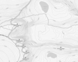
Trail maps

Photos
Welcome to the majestic Mt. Jefferson, a must-visit gem nestled in the heart of New Hampshire's White Mountains! If you're an avid hiker or someone who simply loves to bask in the beauty of nature, this peak promises an unforgettable adventure.
Standing proudly at 5,712 feet, Mt. Jefferson is the third highest peak in New Hampshire and offers some of the most breathtaking views in the region. As part of the Presidential Range, it provides a challenging yet rewarding experience for outdoor enthusiasts seeking both thrill and tranquility.
The journey to Mt. Jefferson is as captivating as the destination itself. The most popular route is via the Caps Ridge Trail, which starts at Jefferson Notch Road—the highest public road in New Hampshire. This trail is relatively short at about 2.5 miles one way but don't let that fool you; it's known for its steep and rocky sections that will test your hiking skills and endurance.
As you ascend, you'll be greeted by stunning alpine scenery and panoramic vistas that stretch across the Presidential Range and beyond. On clear days, you can even catch glimpses of neighboring peaks like Mt. Washington and Mt. Adams. The summit offers a perfect spot to pause, take in the sweeping views, and perhaps enjoy a well-deserved snack.
For those looking for a longer trek, consider combining your hike with nearby trails such as the Gulfside Trail or exploring other parts of the Presidential Range for an extended adventure.
Remember to pack appropriately—weather conditions can change rapidly in this region, so layers are essential. And always practice Leave No Trace principles to help preserve this beautiful environment for future generations.
Whether you're here for a day hike or planning a multi-day exploration of the White Mountains, Mt. Jefferson stands out as a highlight not to be missed. So lace up your boots, grab your backpack, and get ready to create memories on one of New Hampshire's most iconic peaks!
Useful infos
Rate & open hour
44.3045083
Address
Starting Point
The Mt. Jefferson trails are located in Jefferson, New Hampshire. To get to the start of the trails, take Route 115 east from Jefferson to the trailhead parking lot on the left.
FAQ - Frequently asked questions
What is the elevation of Mt Jefferson?
How long on average?
Is the place are families friendly?
Is there an information center / service center / reception?

She life was a celebration of adventure, joy, and the great outdoors. She lived with a fierce determination to enjoy every moment and to share that joy with others. Her legacy is one of laughter, exploration, and an unwavering love for the natural world. Lydia's spirit continues to inspire those who knew her and those who discover her story, reminding us all to embrace life with open arms and a heart full of joy.
Hikers' opinions
0 out of 5 stars
Based on 0 reviews