Essential information for preparing your hike
| Difficulty | Moderate | |
| Distance | 12.7 KM | |
| Estimated Time | 7h | |
| Height / altitude | 1917 meters | |
| Elevation gain | 1,295 meters | |
| Dog allowed |
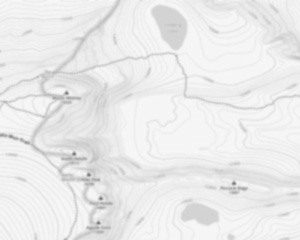
Trail maps

Trails available at Mount Washington
List of suggested loops and routes
| Trails | Distance | Elevation | Type | Difficulty |
|---|---|---|---|---|
Tuckerman Ravine |
12.4 km | 1292 m | Rount trip | Advanced |
Hermit Lake via Tuckerman Ravine Trail |
7.6 km | 564 m | Rount trip | Advanced |
Ammonoosuc Ravine |
13.2 km | 1157 m | Rount trip | Advanced |
Huntington Ravine |
6.4 km | 1300 m | Rount trip | Advanced |
Boott Spur |
15.4 km | 1418 m | Rount trip | Advanced |
Glen Boulder |
16.7 km | 1372 m | Rount trip | Advanced |
Jewell Trail |
8.3 km | 1220 m | Rount trip | Advanced |
↔️ Glissez pour voir tous les détails
Photos
Welcome to mount washington, the crown jewel of New Hampshire's White Mountains and a must-visit destination for hikers and outdoor enthusiasts alike! Known for its breathtaking vistas and challenging trails, mount washington stands as the highest peak in the Northeastern United States, reaching an impressive 6,288 feet.
For those who love a good adventure, mount washington offers a variety of hiking experiences. The most popular route is the Tuckerman Ravine Trail, which provides a thrilling ascent with stunning views along the way. If you're up for a challenge, this trail will reward you with panoramic scenes that stretch across the Presidential Range and beyond.
But don't worry if you're new to hiking or prefer something less strenuous—mount washington has options for everyone. The Auto Road allows you to drive or take a guided tour to the summit, where you can enjoy the same spectacular views without breaking a sweat. Alternatively, the Cog Railway offers a unique and historic ride to the top, providing another way to experience this majestic mountain.
At the summit, you'll find the mount washington Observatory and Weather Discovery Center. Here, you can learn about the mountain's famously unpredictable weather and its role in meteorological research. Be sure to check out Tip Top House, a historic hotel dating back to 1853 that now serves as a museum.
Whether you're seeking an exhilarating hike or simply want to soak in nature's beauty from above, mount washington promises an unforgettable experience. So lace up your boots or hop on board—adventure awaits at New Hampshire's iconic peak!
Services and activities on site
Useful infos
Rate & open hour
44.27058539999999
Starting Point
To access the hiking trails, you can start at several trailheads:
Ammonoosuc Ravine Trailhead: Located at the end of Base Station Road, near the mount washington Cog Railway. The address is 3168 Base Station Rd, Bretton Woods, NH 03589.
Tuckerman Ravine Trailhead: Found at the Pinkham Notch Visitor Center. The address is 2888 NH-16, Gorham, NH 03581.
Jewell Trailhead: Also accessible from Base Station Road, with parking available near the Cog Railway.
Great Gulf Trailhead: Situated off Route 16 in Pinkham Notch. Look for signs directing to Great Gulf Wilderness Parking Area.
Ensure to check weather conditions and trail advisories before heading out.
FAQ - Frequently asked questions
What is the level of difficulty of Mount Washington ?
What is the elevation of Mount Washington?
What is the height of Mount Washington ?
How long on average?
Are dogs allowed?
Is the place are families friendly?
Do I have to pay for parking?
Is there an information center / service center / reception?

She life was a celebration of adventure, joy, and the great outdoors. She lived with a fierce determination to enjoy every moment and to share that joy with others. Her legacy is one of laughter, exploration, and an unwavering love for the natural world. Lydia's spirit continues to inspire those who knew her and those who discover her story, reminding us all to embrace life with open arms and a heart full of joy.
Hikers' opinions
4 out of 5 stars
Based on 20 reviews
5 out of 5 stars
6 years ago3 out of 5 stars
10 years ago4 out of 5 stars
10 years ago4 out of 5 stars
10 years ago