Essential information for preparing your hike
| Estimated Time | 4 to 5 hours | |
| Elevation gain | 905 foots |
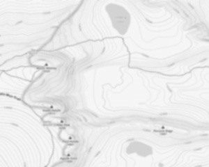
Trail maps

Photos
Welcome to the ammonoosuc ravine trailhead, a hidden gem nestled in the heart of New Hampshire's White Mountains. If you're a hiker, outdoor enthusiast, or someone simply yearning to reconnect with nature, this trail promises an unforgettable adventure.
The ammonoosuc ravine trailhead serves as the gateway to some of the most breathtaking landscapes in the region. Located near Mount Washington, this trail offers a challenging yet rewarding experience for those ready to embrace its rugged beauty. As you embark on your journey, you'll be greeted by lush forests and the soothing sounds of cascading streams that accompany you along the way.
This trail is renowned for its stunning vistas and diverse terrain. As you ascend, you'll encounter everything from serene woodland paths to rocky outcrops offering panoramic views of the surrounding peaks. The highlight for many is reaching the Lakes of the Clouds Hut, where you can pause to take in the awe-inspiring scenery before continuing your trek.
Whether you're an experienced hiker seeking a new challenge or a nature lover eager to explore New Hampshire's wilderness, the ammonoosuc ravine trailhead is a must-visit destination. Remember to pack your essentials, wear sturdy footwear, and prepare for changing weather conditions as you make your way through this remarkable landscape.
So lace up your hiking boots and set off on an adventure that promises not only physical exertion but also moments of tranquility and wonder amidst nature's grandeur. The ammonoosuc ravine trailhead awaits—ready to offer you an experience that will linger in your memory long after you've left its trails behind.
Useful infos
Rate & open hour
44.266947
Address
Starting Point
The ammonoosuc ravine trailhead is located in the White Mountain National Forest in New Hampshire. To get there, take Route 302 west from North Conway to the town of Bretton Woods. Turn left onto Base Road and drive for 1.5 miles to the trailhead parking area on the right.
FAQ - Frequently asked questions
What is the elevation of Ammonoosuc Ravine Trailhead?
How long on average?
Is the place are families friendly?
Is there an information center / service center / reception?

She life was a celebration of adventure, joy, and the great outdoors. She lived with a fierce determination to enjoy every moment and to share that joy with others. Her legacy is one of laughter, exploration, and an unwavering love for the natural world. Lydia's spirit continues to inspire those who knew her and those who discover her story, reminding us all to embrace life with open arms and a heart full of joy.
Hikers' opinions
0 out of 5 stars
Based on 0 reviews