Essential information for preparing your hike
| Distance | 10 KM | |
| Estimated Time | 4 to 6 hours. | |
| Elevation gain | 396 foots |
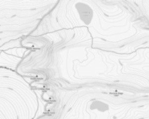
Trail maps

Photos
Discover the Skyline Trail: A Hiker's Paradise in Massachusetts
Welcome to the skyline trail, a hidden gem nestled in the heart of Massachusetts that promises an unforgettable adventure for hikers and outdoor enthusiasts alike. Whether you're a seasoned trekker or someone looking to escape into nature's embrace, this trail offers something special for everyone.
Trail Overview
The skyline trail is part of the Blue Hills Reservation, a sprawling 7,000-acre state park located just a short drive from Boston. This trail is renowned for its stunning vistas, diverse ecosystems, and challenging terrain, making it a must-visit destination for anyone passionate about hiking.
What to Expect
Stretching approximately 9 miles, the skyline trail takes you on a journey through lush forests, rocky outcrops, and serene meadows. As you traverse the trail, you'll encounter breathtaking panoramic views of the Boston skyline—hence the name—and the surrounding countryside. The trail is marked by blue blazes and features several steep ascents and descents, providing both a physical challenge and rewarding scenery.
Highlights Along the Way
One of the standout features of the skyline trail is Great Blue Hill, the highest point in Norfolk County. At 635 feet above sea level, it offers an unparalleled vantage point to soak in sweeping views that extend all the way to New Hampshire on clear days. Don't forget your camera; this is one photo opportunity you won't want to miss!
As you continue along the trail, keep an eye out for local wildlife such as deer, foxes, and a variety of bird species that call this area home. The diverse flora adds another layer of beauty to your hike, with vibrant wildflowers dotting the landscape during spring and summer months.
Tips for Your Adventure
- Preparation: The skyline trail can be demanding at times, so make sure you're well-prepared with sturdy hiking boots, plenty of water, and snacks to keep your energy up.
- Weather: Check weather conditions before heading out. The trail can become slippery after rain or snow.
- Leave No Trace: Help preserve this natural wonder by carrying out everything you bring in and respecting wildlife habitats.
Getting There
The Blue Hills Reservation is easily accessible from Boston via I-93 South. Ample parking is available at various entry points around the reservation. For those relying on public transportation, MBTA buses provide convenient access to nearby stops.
Whether you're seeking solitude in nature or an invigorating day hike with friends or family, the skyline trail in Massachusetts offers an experience that's both challenging and deeply rewarding. Lace up your boots and embark on an adventure that will leave you with memories—and perhaps some sore muscles—that last a lifetime!
Useful infos
Rate & open hour
42.2266742
Address
Starting Point
The skyline trail is located in the Berkshire Mountains of western Massachusetts. The easiest way to get there is to take Route 2 to the town of Charlemont, MA. From there, take Route 8A north to the trailhead parking lot.
FAQ - Frequently asked questions
What is the elevation of Skyline Trail?
How long on average?
Is the place are families friendly?
Is there an information center / service center / reception?

She life was a celebration of adventure, joy, and the great outdoors. She lived with a fierce determination to enjoy every moment and to share that joy with others. Her legacy is one of laughter, exploration, and an unwavering love for the natural world. Lydia's spirit continues to inspire those who knew her and those who discover her story, reminding us all to embrace life with open arms and a heart full of joy.
Hikers' opinions
0 out of 5 stars
Based on 0 reviews