Essential information for preparing your hike
All the information you need to plan your trip at a glance 👇
| Difficulty | Moderate | |
| Distance | 8 KM | |
| Estimated Time | 4 to 6 hours | |
| Elevation gain | 1,079 meters |
Trail maps

Coming Soon
Photos
Explore in images the best this hiking trail has to offer: varied landscapes, spectacular views and unspoiled nature.
Traveler Mountain is a mountain located in Piscataquis County, Maine, in Baxter State Park. The Traveler, is the eighth-most prominent in Maine. Subsidiary peaks include the Peak of the Ridges 3,225 ft (983 m) North and South Traveler Mountain 3,144 ft (958 m) and 2,677 ft (816 m), respectively.
The Traveler stands within the watershed of the Penobscot River, which drains into Penobscot Bay on the coast of Maine. The east side of the Traveler drains into the East Branch of the Penobscot River. The north and west sides of the Traveler drain by several brooks into Trout Brook, then into Grand Lake Matagamon, the source of the East Branch of the Penobscot. The south side of the Traveler drains into the Pogy Brook, then into Wassataquoik Stream and the East Branch.
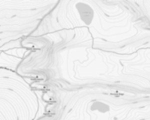
The Traveler was named by loggers using the East Branch of the Penobscot River. As any distant object will appear to do, it seemed to move along with them as they went down river. Upper and Lower South Branch Ponds are at the western base of the Traveler. Three ridges descend the western slopes of the mountain and provide access to the summit. These ridges are from North to South: North Traveler Ridge, Center Ridge and Pinnacle Ridge. North Traveler Ridge of course leads to the Northern summit. The other two ridges begin near the thoroughfare between the two ponds and proceed up to the peak of the ridges 3,225 ft (983 m). Both routes then merge on the way from the Peak of the Ridges to the summit of the Traveler.
Useful infos
Rate & open hour
Access fee
$ 0.00
Schedule
No information
Coordinates
-68.844613
46.07277
46.07277
Address
Starting Point
To access the hiking trails, you can start at the South Branch Pond Campground. The address is Baxter State Park, T6 R9 WELS, ME 04462. This location serves as a primary trailhead for the area.
FAQ - Frequently asked questions
What is the level of difficulty of The Traveler, Maine ?
What is the elevation of The Traveler, Maine?
How long on average?
4 to 6 hours
Is the place are families friendly?
No
Is there an information center / service center / reception?
No

Shared by
Lydia Crawford, an extraordinary woman with an insatiable zest for life, has become an inspirational figure to many through her adventures and infectious good humor. Born and raised in a small town nestled in the mountains, Lydia developed a love for the outdoors at an early age. Her childhood was filled with hiking, camping, and exploring the wilderness, experiences that shaped her into the avid outdoorswoman she is today.
She life was a celebration of adventure, joy, and the great outdoors. She lived with a fierce determination to enjoy every moment and to share that joy with others. Her legacy is one of laughter, exploration, and an unwavering love for the natural world. Lydia's spirit continues to inspire those who knew her and those who discover her story, reminding us all to embrace life with open arms and a heart full of joy.
She life was a celebration of adventure, joy, and the great outdoors. She lived with a fierce determination to enjoy every moment and to share that joy with others. Her legacy is one of laughter, exploration, and an unwavering love for the natural world. Lydia's spirit continues to inspire those who knew her and those who discover her story, reminding us all to embrace life with open arms and a heart full of joy.
Hikers' opinions
3 out of 5 stars
Based on 2 reviews
3 out of 5 stars
10 years ago