Essential information for preparing your hike
| Difficulty | Easy | |
| Estimated Time | 6 to 8 hours. | |
| Elevation gain | 1,219 meters |
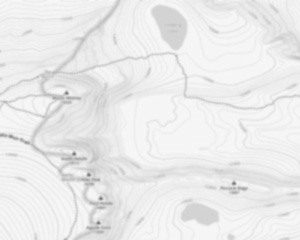
Trail maps

Photos
Welcome to the serene wilderness of Mount Redington, nestled in the heart of Maine's stunning landscape. If you're a hiker, outdoor enthusiast, or someone simply yearning to reconnect with nature, this hidden gem is calling your name.
Mount Redington stands proudly at an elevation of 4,010 feet, making it one of Maine's notable peaks. While it's not part of the official New England 4,000-footer list due to its lack of a maintained trail to the summit, it offers a unique adventure for those who seek solitude and a bit of challenge off the beaten path.
The journey to Mount Redington is as rewarding as reaching its summit. The trails leading up are less traveled, providing a peaceful escape from crowded paths. As you hike through dense forests and across gentle streams, you'll be enveloped by the sounds and sights of untouched nature. Keep an eye out for local wildlife; moose and deer are known to make appearances along these trails.
For those who love a good hiking challenge, Mount Redington offers an opportunity to test your navigation skills. The most common route involves bushwhacking from nearby trails like the Appalachian Trail or logging roads that crisscross the area. It's essential to come prepared with a map and compass or GPS device to ensure a safe and enjoyable trek.
Once you reach the summit, you'll be rewarded with breathtaking views of Maine's rugged terrain. On clear days, you can see neighboring peaks such as Sugarloaf Mountain and Crocker Mountain. The sense of accomplishment paired with the panoramic vistas makes every step worthwhile.
Whether you're an experienced hiker looking for your next conquest or someone eager to explore Maine's natural beauty, Mount Redington promises an unforgettable experience. Remember to pack plenty of water, snacks, and layers for changing weather conditions—Maine's mountains can be unpredictable!
So lace up your hiking boots and set out on an adventure that promises tranquility and awe-inspiring beauty. Mount Redington awaits!
Useful infos
Rate & open hour
45.025031
Address
Starting Point
To access the hiking trails, you can start from the Caribou Valley Road (CVR) trailhead. The CVR is a rough, unpaved road, so a high-clearance vehicle is recommended. The trailhead is located near the end of Caribou Valley Road, which can be accessed from Route 27. There are no official parking lots, but hikers typically park along the roadside. Please ensure your vehicle is parked safely and does not obstruct traffic or private property.
FAQ - Frequently asked questions
What is the level of difficulty of Mount Redington, Maine ?
What is the elevation of Mount Redington, Maine?
How long on average?
Is the place are families friendly?
Is there an information center / service center / reception?

She life was a celebration of adventure, joy, and the great outdoors. She lived with a fierce determination to enjoy every moment and to share that joy with others. Her legacy is one of laughter, exploration, and an unwavering love for the natural world. Lydia's spirit continues to inspire those who knew her and those who discover her story, reminding us all to embrace life with open arms and a heart full of joy.
Hikers' opinions
3 out of 5 stars
Based on 13 reviews
3 out of 5 stars
10 years ago4 out of 5 stars
10 years ago4 out of 5 stars
10 years ago3 out of 5 stars
10 years ago