Essential information for preparing your hike
All the information you need to plan your trip at a glance 👇
| Estimated Time | 4 to 5 hours | |
| Elevation gain | 554 meters |
Trail maps

Coming Soon
Photos
Explore in images the best this hiking trail has to offer: varied landscapes, spectacular views and unspoiled nature.
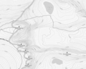
Saddle Peak is a mountain located in the Santa Monica Mountains between Malibu and Calabasas. The summit is accessible via the Backbone Trail. There is also a feeder trail to the top from near the top of Stunt Road (just 1 block below the ridge intersection with Scheuren Road at the viewpoint) maintained by the Santa Monica Mountains Conservancy. And there is an informal trail up the bottom East nose of the massif right across the intersection from the Scheuren Viewpoint. This latter trail passes around a watertower and eventually joins the main trails near the top.
Vegetation is sparse on the peak; dwarf forest and chapparal on the approaches, scrub and grassy at the top. Some oaks at lower elevations.
The true summit is the SouthEastern hummock, much degraded. Views from here are of the Pacific Ocean to the West, and other ridges and peaks of the Santa Monica Mountains to the East and West. There is a second summit reached by private road, to the Northwest, with a wire-fenced compound of numerous radio relay towers. At the far end beyond the compound is a house site foundation in disrepair. This slope burned in 1989. Beyond and below that is a private road back down to Stunt Road, with private residences below.
There are occasionally rattlesnakes on the SMMC trail.
Useful infos
Rate & open hour
Access fee
$ 0.00
Schedule
No information
Coordinates
-120.793077
35.222312
35.222312
Address
Starting Point
To access the hiking trails, you can start from several trailheads. One option is the trailhead located at the end of Stunt Road, where there is a small parking area available. Another starting point is the trailhead on Schueren Road, which also offers parking facilities. Both locations provide convenient access to the trails.
FAQ - Frequently asked questions
What is the elevation of Saddle Peak, California?
How long on average?
4 to 5 hours
Is the place are families friendly?
No
Is there an information center / service center / reception?
No

Shared by
Lydia Crawford, an extraordinary woman with an insatiable zest for life, has become an inspirational figure to many through her adventures and infectious good humor. Born and raised in a small town nestled in the mountains, Lydia developed a love for the outdoors at an early age. Her childhood was filled with hiking, camping, and exploring the wilderness, experiences that shaped her into the avid outdoorswoman she is today.
She life was a celebration of adventure, joy, and the great outdoors. She lived with a fierce determination to enjoy every moment and to share that joy with others. Her legacy is one of laughter, exploration, and an unwavering love for the natural world. Lydia's spirit continues to inspire those who knew her and those who discover her story, reminding us all to embrace life with open arms and a heart full of joy.
She life was a celebration of adventure, joy, and the great outdoors. She lived with a fierce determination to enjoy every moment and to share that joy with others. Her legacy is one of laughter, exploration, and an unwavering love for the natural world. Lydia's spirit continues to inspire those who knew her and those who discover her story, reminding us all to embrace life with open arms and a heart full of joy.
Hikers' opinions
0 out of 5 stars
Based on 0 reviews