Infos essentielles pour préparer votre randonnée
| Difficulté | Intermédiaire | |
| Distance | 14,3 KM | |
| Temps estimé | 6 to 8 hours | |
| Dénivelé / Gain d'altitude | 1 244 mètres |
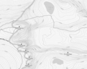
Cartes des sentiers

Photos
Mount Ellen se situe dans l'État du Vermont, à proximité de la ville de Warren. Ce sommet fait partie de la chaîne des Montagnes Vertes et culmine à une altitude de 1 244 mètres. Le paysage est caractérisé par des forêts denses et des vues dégagées sur les vallées environnantes. Le climat y est tempéré, avec des hivers enneigés et des étés doux, rendant la randonnée agréable durant plusieurs mois de l'année. Les sentiers sont bien balisés, offrant un accès facile aux randonneurs de tous niveaux.
Le paysage autour de Mount Ellen est dominé par une forêt mixte composée principalement d'érables et de bouleaux. La faune locale inclut des cerfs de Virginie et divers oiseaux chanteurs, ce qui en fait un lieu intéressant pour les amateurs de nature. Les sentiers varient en difficulté, allant de chemins rocailleux à des passages plus doux sous les bois.
Les sentiers principaux incluent le Jerusalem Trail VT, qui offre une boucle pittoresque avec quelques points de vue panoramiques sur les montagnes environnantes. La distance totale du parcours est d'environ 14,32 km, ce qui représente une journée complète de randonnée pour la plupart des visiteurs.
Préparez votre randonnée à Mount Ellen
Altitude et difficulté
Mount Ellen atteint une altitude de 1 244 mètres. Les sentiers présentent un niveau de difficulté modéré à difficile, convenant aux randonneurs expérimentés.
Distance et durée
La longueur totale du parcours principal est de 14,32 km, avec un temps estimé entre 5 et 7 heures selon le rythme du marcheur.
Accès payant ou gratuit
L'accès au Mount Ellen est gratuit pour tous les visiteurs.
Adapté aux enfants ?
Les sentiers ne sont pas particulièrement adaptés aux jeunes enfants en raison du dénivelé et des sections rocheuses.
Chien permis
Les chiens sont admis sur les sentiers mais doivent être tenus en laisse en tout temps.
Meilleure période et conseils pratiques
Quand y aller ?
La meilleure période pour visiter Mount Ellen s'étend du printemps à l'automne. Les conditions météorologiques typiques incluent des températures douces et peu d'humidité durant ces saisons.
Équipement recommandé
- Chaussures de randonnée robustes
- Vêtements adaptés aux conditions climatiques (couches)
- Protection solaire (chapeau, crème solaire)
- Bâtons de marche pour le soutien
Sécurité et précautions
- Vérifier la météo avant de partir
- Informer un proche de votre itinéraire
- Avoir une trousse de premiers soins
- Respecter la signalisation et les consignes locales
- Apporter un téléphone chargé avec GPS
Envisagez une visite à Mount Ellen pour découvrir ses paysages variés et profiter d'une expérience enrichissante en pleine nature. Pour plus d'informations sur d'autres randonnées dans le Vermont, consultez notre site dédié aux aventures en plein air.
Infos pratiques
Tarif et heures d'ouvertures
44,159897
Adresse
Point de départ
Pour accéder aux sentiers de randonnée, vous pouvez commencer à plusieurs points de départ. Voici les informations nécessaires pour vous y rendre :
Lincoln Gap Road : Ce point de départ est accessible via Lincoln Gap Road. Vous pouvez stationner au sommet du col, où un petit parking est disponible. L'adresse approximative est :
- Lincoln Gap Road, Warren, VT 05674
Appalachian Gap : Un autre point de départ se trouve à l'Appalachian Gap sur la Route 17. Il y a un parking situé directement au col.
- Appalachian Gap, Route 17, Waitsfield, VT 05673
German Flats Road : Pour ceux qui préfèrent une approche différente, il y a un accès via German Flats Road avec un parking disponible près du Sugarbush Resort.
- German Flats Road, Warren, VT 05674
Assurez-vous de vérifier les conditions routières et météorologiques avant votre départ, car certaines routes peuvent être fermées ou difficiles d'accès en fonction des saisons.
FAQ – Questions fréquentes
Quel est le niveau de difficulté du Mount Ellen, Vermont?
Quelle est dénivelé du Mount Ellen, Vermont ?
Quelle est la durée de la montée (estimée) ?
L'endroit est-il adapté aux familles ?
Est-ce qu'il y a un centre d'information / centre de services / réception ?

Je désire déconnecter les gens du monde virtuel pour les connecter au monde réel. Je veux les reconnecter avec la nature. Je veux que les gens arrêtent de SURvivre, et commencent à vivre ! Je veux communiquer le sentiment de liberté, d’épanouissement que je vis moi-même dans la nature !
Avis des randonneurs
4 sur 5 étoiles
Basé sur 6 avis
4 sur 5 étoiles
il y a 11 ans4 sur 5 étoiles
il y a 11 ans4 sur 5 étoiles
il y a 11 ans