 Par
Par

Chien autorisé
Base plein air André-Nadeau
19 commentaires
Distance: 3,5 km
Élévation 60 m
5302 Chem. Blanchette, Sherbrooke, QC J1N 0C7, Canada ,
Québec
, Cantons-de-l'Est
Téléphone (819) 864-1907
http://basepleinair.ca/
Accès gratuit
Chien autorisé
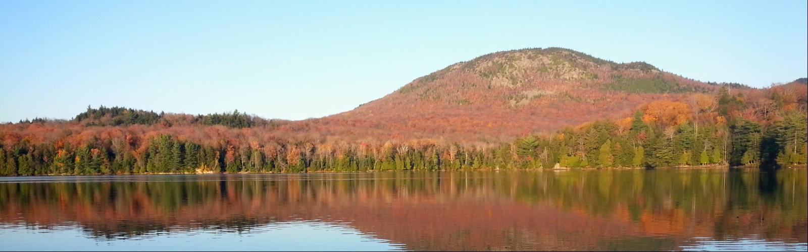
Lac Spruce
6 commentaires
Élévation 200 m
Québec
, Cantons-de-l'Est
Chien autorisé
Distance: 3 km
Élévation 150 m
Québec
, Cantons-de-l'Est
Chien autorisé
Mont Chauve
9 commentaires
Distance: 9,6 km
Élévation 470 m
3321 Chemin du Parc, Orford, QC J1X 7A2, Canada ,
Québec
, Cantons-de-l'Est
Téléphone (800) 665-6527
https://www.sepaq.com/pq/mor/
Coût 8,90
Chien autorisé
Mont Gosford
12 commentaires
Distance: 19 km
Élévation 540 m
Québec
, Cantons-de-l'Est
Téléphone 819 544-9004
Coût 11,00
| Nom sentier | Distance | Difficulté |
|---|---|---|
Sentier principal - 1 |
81,00 km | Avancé |
Sentier du Ruisseau Morin - 6 (secteur mont Gosford) |
9,40 km | Intermédiaire |
Sentier du Cap-Frontière - 7 (secteur mont Gosford) |
6,80 km | Intermédiaire |
Sentier des Sommets - 5 (secteur montagne de Marbre) |
3,20 km | Intermédiaire |
Mont d'Urban à mont Mégantic - 9 |
25,20 km | Intermédiaire |
Sentier du Col - 8 (secteur mont Gosford) |
2,20 km | Intermédiaire |
Sentier du Lac Danger - 2 (secteur montagne de Marbre) |
2,50 km | Débutant |
Chemin forestier - 2 (secteur montagne de Marbre) |
2,20 km | Débutant |
Sentier de la Chouette - 3 (secteur montagne de Marbre) |
1,00 km | Débutant |
Chien autorisé
Parc Du Domaine Howard
8 commentaires
Distance: 2 km
Élévation 30 m
1300 Boul de Portland, Sherbrooke, QC J1J 1S3, Canada ,
Québec
, Cantons-de-l'Est
Téléphone (819) 801-4227
http://www.destinationsherbrooke.com/en/visitors/what-to-do/domaine-howard
Chien autorisé
Parc du Mont-Bellevue
4 commentaires
Distance: 6 km
Élévation 125 m
OrganisationAddress ,
Québec
, Cantons-de-l'Est
Téléphone (518) 381-4700
http://mapleskiridge.com/
Accès gratuit
Chien autorisé
Distance: 25 km
Élévation 20 m
Québec
, Cantons-de-l'Est
Chien autorisé
Parc national de la Yamaska
10 commentaires
Distance: 39 km
Élévation 50 m
1780 Bd David Bouchard, Roxton Pond, QC J0E 1Z0, Canada ,
Québec
, Cantons-de-l'Est
Téléphone (450) 776-7182
https://www.sepaq.com/pq/yam
Coût 8,90
| Nom sentier | Distance | Difficulté |
|---|---|---|
Le Grand-Tour |
19,00 km | Intermédiaire |
La Digue |
5,80 km | Débutant |
La Forestière |
5,50 km | Débutant |
La Rivière |
2,50 km | Débutant |
La Pinède |
10,30 km | Débutant |
Chien autorisé
Parc National Du Mont-Mégantic
18 commentaires
Distance: 120,4 km
Élévation 480 m
189, route du Parc Notre-Dame-des-Bois (Québec) J0B 2E0 ,
Québec
, Cantons-de-l'Est
Téléphone 819 888-2941
https://www.sepaq.com/pq/mme/
Coût 8,90
| Nom sentier | Distance | Difficulté |
|---|---|---|
Sentier du Mont-Mégantic |
5,00 km | Avancé |
Sentier du Col |
4,50 km | Avancé |
Sentier du Mont-Saint-Joseph |
3,00 km | Avancé |
Les Cimes-de-Franceville |
6,00 km | Intermédiaire |
Sentier du Mont-Notre-Dame |
5,10 km | Intermédiaire |
Piste de la Vallée |
3,90 km | Intermédiaire |
Promenade Boréale |
2,20 km | Intermédiaire |
Sentier de la Petite-Ourse |
2,50 km | Débutant |
Promenade du Ruisseau |
1,50 km | Débutant |
Sentier de la Grande-Ourse |
1,30 km | Débutant |
Chien autorisé
Parc National Du Mont-mégantic
18 commentaires
Distance: 120,4 km
Élévation 480 m
189, route du Parc Notre-Dame-des-Bois (Québec) J0B 2E0 ,
Québec
, Cantons-de-l'Est
Téléphone 819 888-2941
https://www.sepaq.com/pq/mme/
Coût 8,90
| Nom sentier | Distance | Difficulté |
|---|---|---|
Sentier du Mont-Mégantic |
5,00 km | Avancé |
Sentier du Col |
4,50 km | Avancé |
Sentier du Mont-Saint-Joseph |
3,00 km | Avancé |
Les Cimes-de-Franceville |
6,00 km | Intermédiaire |
Sentier du Mont-Notre-Dame |
5,10 km | Intermédiaire |
Piste de la Vallée |
3,90 km | Intermédiaire |
Promenade Boréale |
2,20 km | Intermédiaire |
Sentier de la Petite-Ourse |
2,50 km | Débutant |
Promenade du Ruisseau |
1,50 km | Débutant |
Sentier de la Grande-Ourse |
1,30 km | Débutant |
Chien autorisé
Parc régional du Mont Ham
32 commentaires
Distance: 20 km
Élévation 336 m
103 Route 257 Ouest, Saint-Joseph-de-Ham-Sud, QC J0B 3J0, Canada ,
Québec
, Cantons-de-l'Est
Téléphone (819) 828-3608
http://montham.ca/fr#1
Coût 8,00
•
4,00
| Nom sentier | Distance | Difficulté |
|---|---|---|
Le Button |
3,20 km | Intermédiaire |
Le Panoramique |
2,10 km | Intermédiaire |
L'Intrépide |
1,90 km | Intermédiaire |
Les Légendes |
1,10 km | Intermédiaire |
Boucle du Mont Ham |
6,00 km | Intermédiaire |
Boucle du Mont Ham |
6,00 km | Avancé |
L'Épervier |
3,20 km | Intermédiaire |
Tour du Button |
1,80 km | Intermédiaire |
Le Bouleau |
1,40 km | Intermédiaire |
Les Cèdres |
0,80 km | Débutant |
Sentier Téméraire |
0,40 km | Intermédiaire |
Waban-Aki |
0,90 km | Débutant |
Sentier des Pins |
0,90 km | Débutant |
Chien autorisé
Promenade du Lac-des-Nations
7 commentaires
Distance: 3,5 km
Élévation 20 m
Québec
, Cantons-de-l'Est
Accès gratuit
Chien autorisé
Distance: 19 km
Élévation 20 m
Québec
, Cantons-de-l'Est
Accès gratuit
Chien autorisé
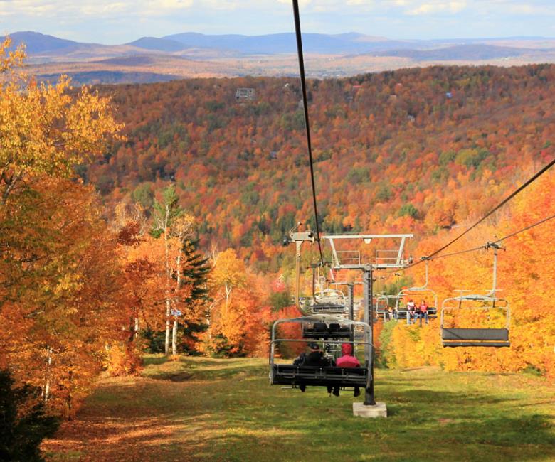
Station Touristique Mont Owl's Head
24 commentaires
Distance: 10,4 km
Élévation 540 m
40 Chemin du Mont Owls Head, Mansonville, QC J0E 1X0, Canada ,
Québec
, Cantons-de-l'Est
Téléphone (800) 363-3342
http://owlshead.com/
Accès gratuit
| Nom sentier | Distance | Difficulté |
|---|---|---|
Sentier L'Échappée |
1,20 km | Intermédiaire |
Sentier Abénakis-Maçonnique |
2,00 km | Intermédiaire |
Sentier Chalet |
3,20 km | Avancé |
Sentier Panorama |
5,40 km | Avancé |
Chien autorisé
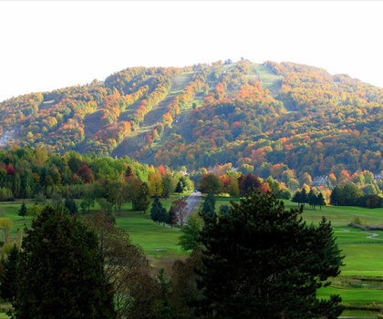
Mont Bromont
23 commentaires
Distance: 6 km
Élévation 342 m
Québec
, Cantons-de-l'Est
Téléphone 450 534-2006
http://www.sentiersbromont.org/
Coût 12,00
| Nom sentier | Distance | Difficulté |
|---|---|---|
C6 - Colorée |
2,20 km | Avancé |
C5 - Cirrus |
0,70 km | Avancé |
C18 - Comète |
0,20 km | Avancé |
C14 - Divine |
2,90 km | Intermédiaire |
M29- Hollywood |
2,00 km | Intermédiaire |
M40 - Le Fer à cheval |
1,50 km | Intermédiaire |
C4 - Conquête |
1,50 km | Intermédiaire |
M31 - Le stade Olympique |
1,20 km | Intermédiaire |
M30 - L'Entrecôte |
1,20 km | Intermédiaire |
M32 - La Montée |
1,00 km | Intermédiaire |
C15 - Démone |
1,00 km | Intermédiaire |
C16 - Cumulus |
0,90 km | Intermédiaire |
C17 - Céleste |
0,60 km | Intermédiaire |
C3 - Capable |
0,60 km | Intermédiaire |
M34- La Relique |
0,50 km | Intermédiaire |
M38 - L'échangeur Turcotte |
0,42 km | Intermédiaire |
C19 - Ligament |
0,40 km | Intermédiaire |
C20 - Cosmos |
0,20 km | Intermédiaire |
C1 - Ceinture de randonnée |
15,10 km | Débutant |
C2 - Cantons |
1,80 km | Débutant |
C7 - Château |
0,70 km | Débutant |
Chien autorisé
Mont Sutton
26 commentaires
Distance: 52 km
Élévation 432 m
671 Rue Maple, Sutton, QC J0E 2K0, Canada ,
Québec
, Cantons-de-l'Est
Coût 7,00
•
3,00
| Nom sentier | Distance | Difficulté |
|---|---|---|
Passe des Caps |
1,00 km | Débutant |
Mont Gagnon |
8,00 km | Avancé |
Dos d'orignal |
7,30 km | Avancé |
Nombril |
6,30 km | Avancé |
Lac Mohawk |
5,60 km | Avancé |
Sentier du Round Top |
5,60 km | Avancé |
Vieux chemin |
3,90 km | Intermédiaire |
Lac Spruce |
3,10 km | Intermédiaire |
L'Arrault |
1,10 km | Intermédiaire |
Village Montagne |
4,50 km | Débutant |
Marmite des Sorcières |
1,80 km | Débutant |
Chute du Pékan |
1,40 km | Débutant |
Chien autorisé
Parc De La Gorge De Coaticook
14 commentaires
Distance: 18,5 km
Élévation 152 m
400 Rue Saint-Marc, Coaticook, QC J1A 2R9, Coaticook, QC J1A 2M3, Canada ,
Québec
, Cantons-de-l'Est
Téléphone (888) 524-6743
http://www.gorgedecoaticook.qc.ca/
Coût 8,00
•
4,75
| Nom sentier | Distance | Difficulté |
|---|---|---|
Sentier Tillotson |
8,50 km | Avancé |
Sentier de la Promenade |
3,50 km | Débutant |
Sentier de la Gorge |
3,50 km | Débutant |
Chien autorisé
Parc d'environnement naturel de Sutton
26 commentaires
Distance: 52 km
Élévation 432 m
671 Rue Maple, Sutton, QC J0E 2K0, Canada ,
Québec
, Cantons-de-l'Est
Coût 7,00
•
3,00
| Nom sentier | Distance | Difficulté |
|---|---|---|
Passe des Caps |
1,00 km | Débutant |
Mont Gagnon |
8,00 km | Avancé |
Dos d'orignal |
7,30 km | Avancé |
Nombril |
6,30 km | Avancé |
Lac Mohawk |
5,60 km | Avancé |
Sentier du Round Top |
5,60 km | Avancé |
Vieux chemin |
3,90 km | Intermédiaire |
Lac Spruce |
3,10 km | Intermédiaire |
L'Arrault |
1,10 km | Intermédiaire |
Village Montagne |
4,50 km | Débutant |
Marmite des Sorcières |
1,80 km | Débutant |
Chute du Pékan |
1,40 km | Débutant |
Chien autorisé
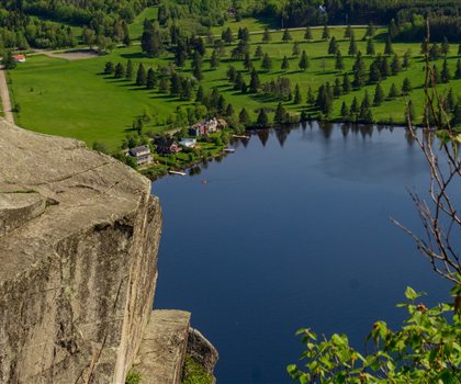
Parc Harold F. Baldwin (Mont Pinacle)
21 commentaires
Distance: 4,4 km
Élévation 296 m
1891 Chemin May Baldwin Mills Coaticook QC J1A 2S4 Canada ,
Québec
, Cantons-de-l'Est
https://parchfbaldwin.com/
Coût 6,00
| Nom sentier | Distance | Difficulté |
|---|---|---|
Mont Pinacle |
4,41 km | Intermédiaire |
Sentier de l'Érablière |
1,91 km | Débutant |
Sentier de la Rocheuse |
0,55 km | Débutant |
Sentier du Petit lac |
0,26 km | Débutant |
Sentier Faucon Pèlerin |
0,51 km | Débutant |
Sentier le Grimpeur |
1,00 km | Débutant |
Sentier Mead |
0,50 km | Débutant |
Chien autorisé
Parc national de Frontenac
14 commentaires
Distance: 39,5 km
Élévation 120 m
599 Chem. des Roy, Sainte-Praxède, QC G0M 1H1, Canada ,
Québec
, Cantons-de-l'Est
Téléphone (800) 665-6527
https://www.sepaq.com/pq/fro
| Nom sentier | Distance | Difficulté |
|---|---|---|
Massif de Winslow |
10,20 km | Avancé |
Les Passereaux |
6,50 km | Intermédiaire |
Le Littoral |
8,00 km | Débutant |
La Colline |
7,40 km | Débutant |
Les Grands Pins |
5,70 km | Débutant |
La Tourbière |
5,00 km | Débutant |
L'Érablière |
3,20 km | Débutant |
Chien autorisé
Parc National Du Mont-Orford
33 commentaires
Distance: 82,2 km
Élévation 725 m
3321 Chemin du Parc, Orford, QC J1X 7A2, Canada ,
Québec
, Cantons-de-l'Est
Téléphone (800) 665-6527
https://www.sepaq.com/pq/mor/
Coût 8,90
| Nom sentier | Distance | Difficulté |
|---|---|---|
Boucle du Mont-Chauve |
6,50 km | Avancé |
Chemin d'accès au Vallonnier |
5,00 km | Intermédiaire |
Lien mont Orford - salle communautaire |
6,20 km | Intermédiaire |
Sentier de la Chouette |
3,80 km | Intermédiaire |
Sentier de la Gélinotte |
3,70 km | Intermédiaire |
Sentier de la Sitelle |
1,60 km | Débutant |
Sentier des Loutres |
4,30 km | Avancé |
Sentier du Cerf |
8,50 km | Avancé |
Sentier du Coyote |
1,60 km | Débutant |
Sentier du Lynx |
3,80 km | Intermédiaire |
Sentier du Pékan |
4,10 km | Intermédiaire |
Sentier du Ruisseau-David |
4,20 km | Avancé |
Sentier du Ruisseau-des-Chênes |
2,90 km | Avancé |
Chien autorisé
Parc national du Mont-orford
33 commentaires
Distance: 82,2 km
Élévation 725 m
3321 Chemin du Parc, Orford, QC J1X 7A2, Canada ,
Québec
, Cantons-de-l'Est
Téléphone (800) 665-6527
https://www.sepaq.com/pq/mor/
Coût 8,90
| Nom sentier | Distance | Difficulté |
|---|---|---|
Boucle du Mont-Chauve |
6,50 km | Avancé |
Chemin d'accès au Vallonnier |
5,00 km | Intermédiaire |
Lien mont Orford - salle communautaire |
6,20 km | Intermédiaire |
Sentier de la Chouette |
3,80 km | Intermédiaire |
Sentier de la Gélinotte |
3,70 km | Intermédiaire |
Sentier de la Sitelle |
1,60 km | Débutant |
Sentier des Loutres |
4,30 km | Avancé |
Sentier du Cerf |
8,50 km | Avancé |
Sentier du Coyote |
1,60 km | Débutant |
Sentier du Lynx |
3,80 km | Intermédiaire |
Sentier du Pékan |
4,10 km | Intermédiaire |
Sentier du Ruisseau-David |
4,20 km | Avancé |
Sentier du Ruisseau-des-Chênes |
2,90 km | Avancé |